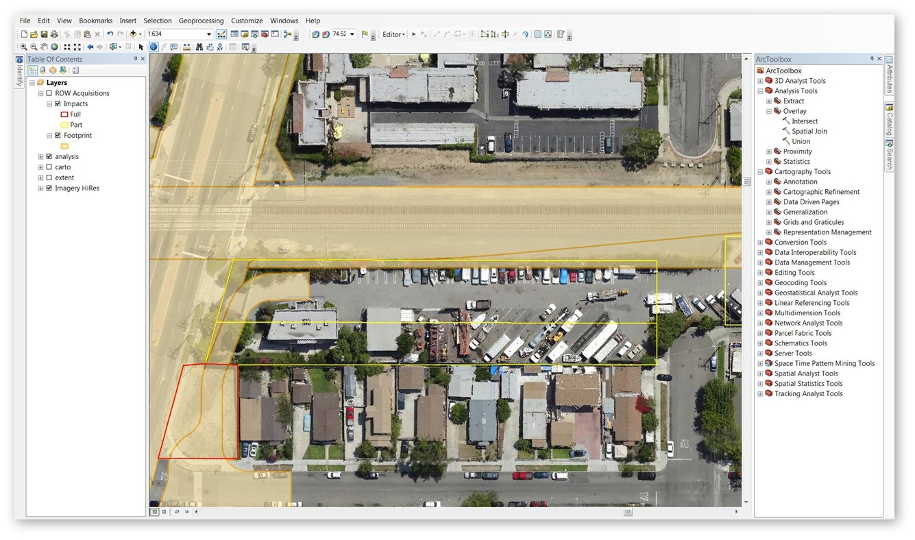
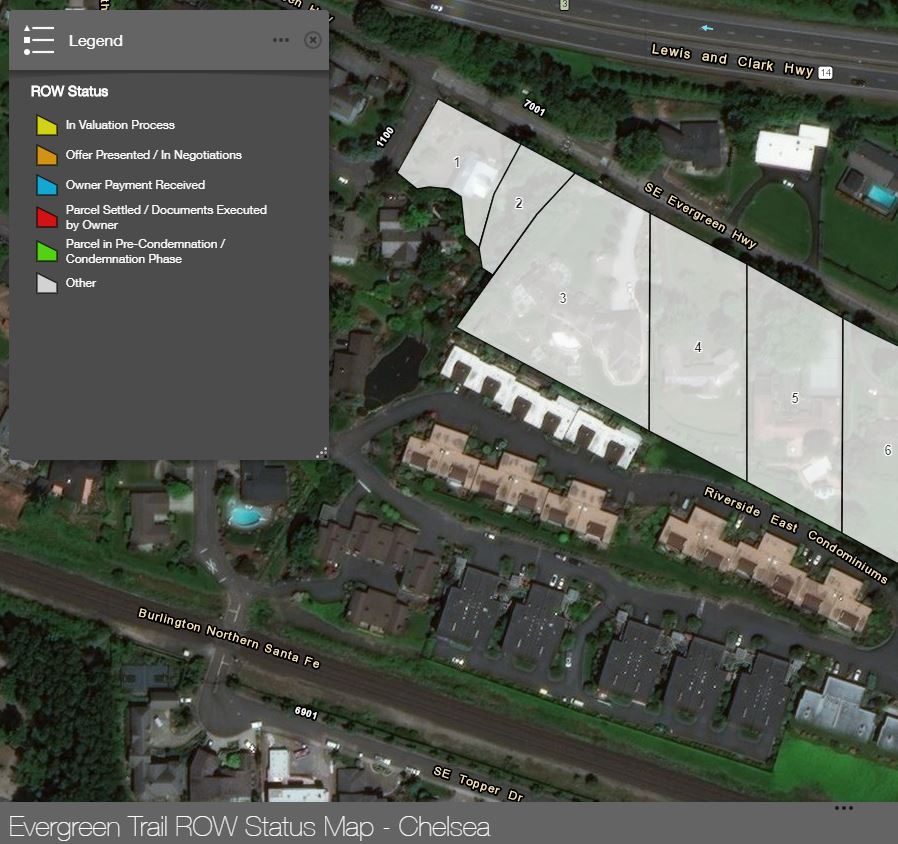
Geographic Information System (GIS)
Epic utilizes Geographic information Systems (GIS) to analyze and manage spatial data using the industry-leading ESRI ArcGIS platform. Epic publishes interactive maps and applications to the web for use on computers, smartphones, and tablets. Clients are empowered with access to custom, web-based right of way maps designed to optimize analytics, collaboration, and project management. Live streaming of data from cloud servers ensures that users are always viewing the most current information. Advancements in mobile technology allow Epic to support android and iOS tablet-based field data collection. The ArcGIS Collector App empowers users with the ability to download project data before heading into remote environments, utilize GPS technology to digitize shapes, type in attribute data, take pictures, and sync data back to the server. Data collected in the field can then be integrated into PDF exhibit maps or displayed on the web.
Features
- Customized web and mobile map application to suit your needs
- Interface for agents, project managers, and clients to view property information on a dynamic map and update records
- Mobile application captures data in the field, speeds-up data collection, and increases accuracy
- Project status tracking from desktop or in-field
- Visualization of parcel attributes
- Visual aid to pair with reports
- Visual aid for project understanding
- Exhibits for displays for community and agency board meetings
- Clients have shared access